
Optimize Your Pipeline Risk Assessment Process
Class location assessment is a critical input for pipeline risk management and regulatory compliance. Based on the density of dwellings intended for human occupancy near the pipeline corridor, the class location of the pipeline is defined. As population density increases, so do monitoring requirements and safety obligations under PHMSA/CER regulations.
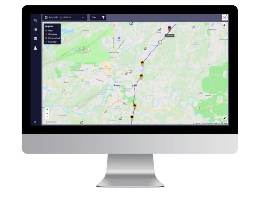
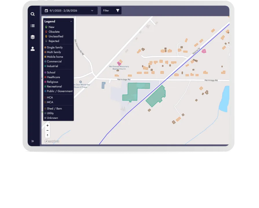
For the purpose of PHMSA/CER compliance, our tool offers a satellite-powered approach to class location assessment, transforming a traditionally time-consuming and labor-intensive process into a scalable, consistent and frequently updated solution. By continuously detecting and monitoring buildings along the pipeline corridor and its Right-of-Way, operators can proactively identify changes in population density and minimize potential impact before incidents occur, not after.
Why Use Our Class Location Service?
Our solution automatically identifies new and obsolete dwellings across an extended corridor using advanced satellite analytics. This removes the need for year-long manual surveys, allowing operators to complete class location assessments in just 1 hour instead of months using a tool designed especially for your GIS and GIP teams.
Let us automate your existing workflow so you can focus on what matters most. Cut effort by 95%.
See Every Change.
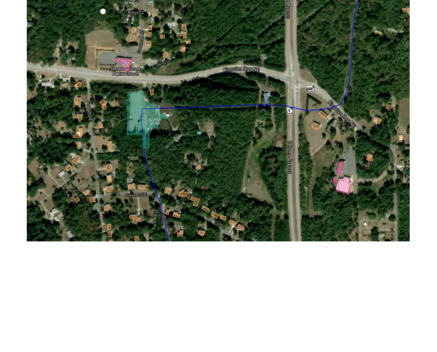
Continuous detection of new and removed dwellings across your corridor keeps Class Location inputs accurate for risk assessments. Monitor up to a 700 ft corridor for added context, including remote areas, without putting boots on the ground.
Zero Manual Work.
Class Location integrates seamlessly with your existing dwelling baseline and workflows. From day one, your baseline is continuously updated with 95% detection accuracy. No manual surveys, no fragmented datasets, no delays. What used to take months can now be done in an hour.
Market-Specific Solution.
Built with North American pipeline operators to support PHMSA/CER workflows and audits. It brings everything into one place and produces GIS ready outputs, saving your team time and helping you stay audit ready with confidence in your compliance decisions.
Compliance Ready
PHMSA-compliant by design, our service supports PHMSA/CER class location requirements, which directly impact integrity management, inspection frequency, and mitigation measures.
By maintaining an accurate, continuously updated view of dwellings near your pipeline, our Class Location service helps to meet regulatory standards, simplify audits, and demonstrate proactive risk management without scrambling when inspections arise.
Integrated seamlessly into existing GIS and GIP operations, it turns class location assessments into a fast, reliable, and compliant workflow rather than a once-a-year headache.
Upgrade How You Manage Risk
Reducing costs starts with better data and smarter workflows. Automating class location assessment eliminates the need for frequent manual surveys. It lowers operational expenses while reducing unnecessary inspections and mitigation measures driven by outdated or overly conservative assumptions.
With continuously updated population data, operators can allocate budgets more efficiently, avoid unnecessary capital expenditures, and focus resources where risk is highest. All without the cost and disruption of last-minute compliance efforts.
Ready to Streamline Your Class Location Assessment?