LSNed Transitions from Helicopter Patrols to Continuous Satellite Monitoring
LSNed has replaced its weekly routine helicopter inspections with continuous satellite-based monitoring for the operational oversight of its pipeline corridor in the Netherlands.
Managed by Orbital Eye, this new monitoring approach supports more frequent and scalable detection of activities along one of the Netherlands’ most important underground infrastructure corridors.
About LSNed
Leidingenstraat Nederland (LSNed) is the independent management organisation responsible for the pipeline corridor between Rotterdam and Antwerp. LSNed ensures the safe and uninterrupted use of this corridor and supervises activities in and around the route. The corridor contains approximately 1,400 kilometres of pipelines and around 5,000 kilometres of cables, forming a critical component of the Dutch underground infrastructure network. In addition, the organisation applies its expertise to support the development of future-proof pipeline corridors in the Netherlands.
The Challenge
Following the successful completion of the pilot, LSNed decided to replace its routine helicopter patrols with satellite monitoring as part of its daily operational processes.
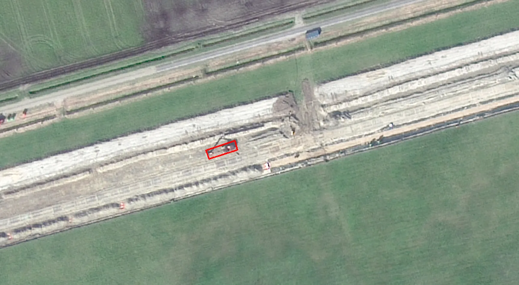
Orbital Eye’s monitoring solution COSMIC-EYE is designed to detect risk-increasing activities near underground infrastructure at an early stage. These include excavation works, construction activities, temporary site installations, and the storage of heavy equipment. By analysing radar, optical, and multispectral satellite data with AI, Orbital Eye translates surface changes into actionable alerts that can be integrated directly into operational workflows.
“As an infrastructure management organisation, we continuously look for ways to improve our oversight,” says Ferdinand van den Oever, Director of LSNed. “Satellite monitoring enables us to gain faster insight into activities along the corridor and to act more effectively. At the same time, it offers a more sustainable approach to supervision, with less disruption to the surrounding environment.”
Results and Impact
By adopting satellite monitoring, LSNed gains more consistent, corridor-wide insight into potential risks, enabling earlier intervention compared to periodic aerial inspections.
The transition also reduces dependency on weather- and resource-intensive helicopter patrols, while improving scalability as infrastructure networks grow in size and complexity.
For LSNed, this means:
- more continuous visibility across the corridor
- earlier detection of potentially risk-increasing activities
- reduced reliance on helicopter-based inspections
- a more scalable and sustainable monitoring approach
Looking Ahead
The LSNed case demonstrates how satellite monitoring is moving beyond pilots and innovation projects into daily operations.
“This transition illustrates how satellite monitoring is moving beyond pilots and innovation projects into daily operations,” says Sven van Haver, CEO at Orbital Eye. “The LSNed case demonstrates that continuous, data-driven monitoring can effectively support infrastructure operators in managing risk across large and complex corridors.”
As infrastructure operators face increasing pressure to improve oversight while managing larger and more complex networks, continuous satellite monitoring offers a practical and future-ready way to strengthen operational control.